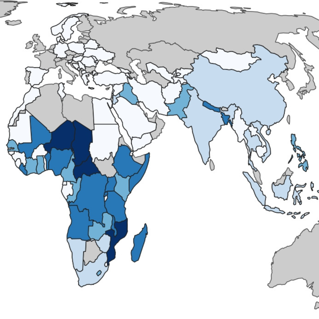
Choropleth Maps
Use varying shades or colors within predefined areas, such as countries or states, to visually represent the distribution and intensity of a specific variable, making it easier to identify spatial patterns and trends.
Currently a bachelor's student pursuing Economics, Human Geography, and Environmental Sciences. My academic interests lie in climate justice, fostering economic resilience in vulnerable countries, and social entrepreneurship. This website features various maps I made using Geographical Information Systems (GIS) technology.
Use varying shades or colors within predefined areas, such as countries or states, to visually represent the distribution and intensity of a specific variable, making it easier to identify spatial patterns and trends.
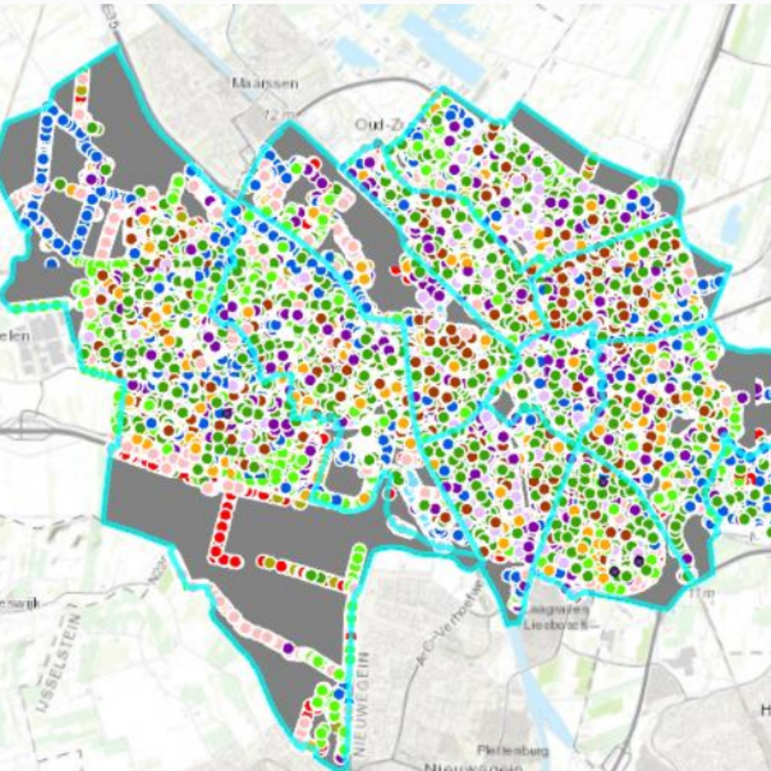
Represent geographical features using points, lines, and polygons based on mathematical equations.
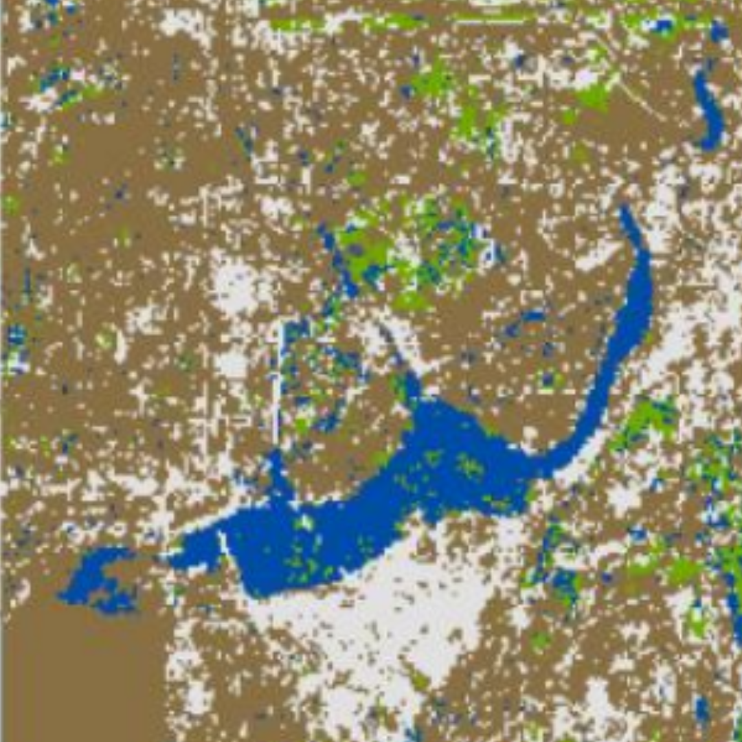
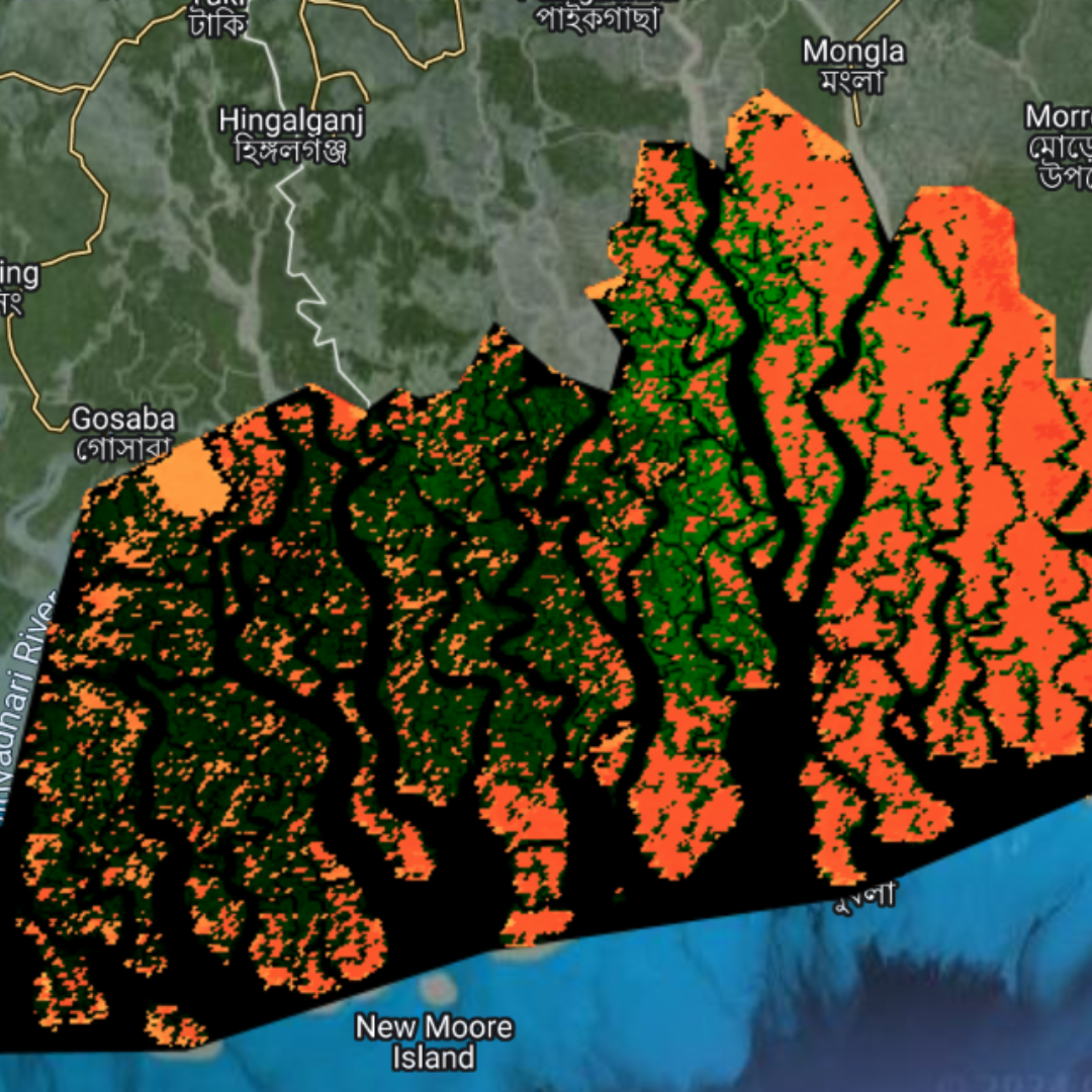
Categorize and depict different types of land surface based on their visual or spectral characteristics.
Use laser pulses to measure distances to the Earth's surface, creating highly detailed 3D representations of terrain and objects.
Visualize locations where carbon is stored in ecosystems.
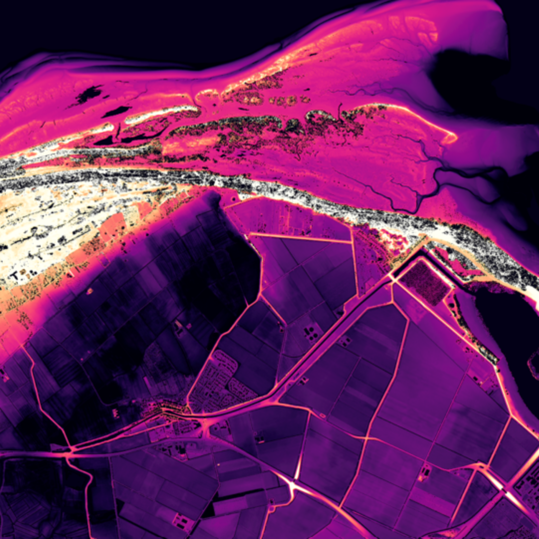
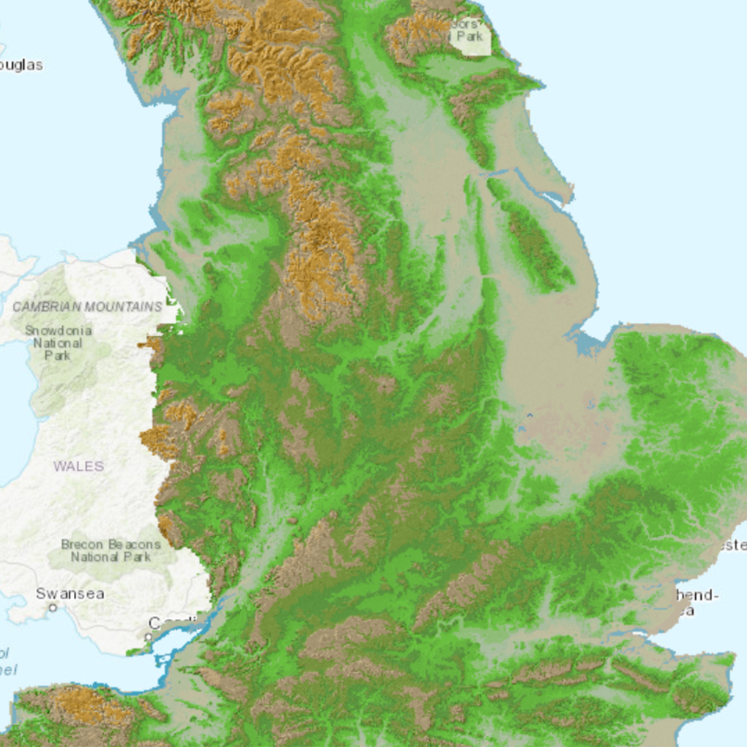
Represents the height of a terrain relative to a specific reference point or surface, highlighting variations in elevation across a landscape.